Flooding

Learn about flooding, including historical statistics and significant flood events that have impacted the area.
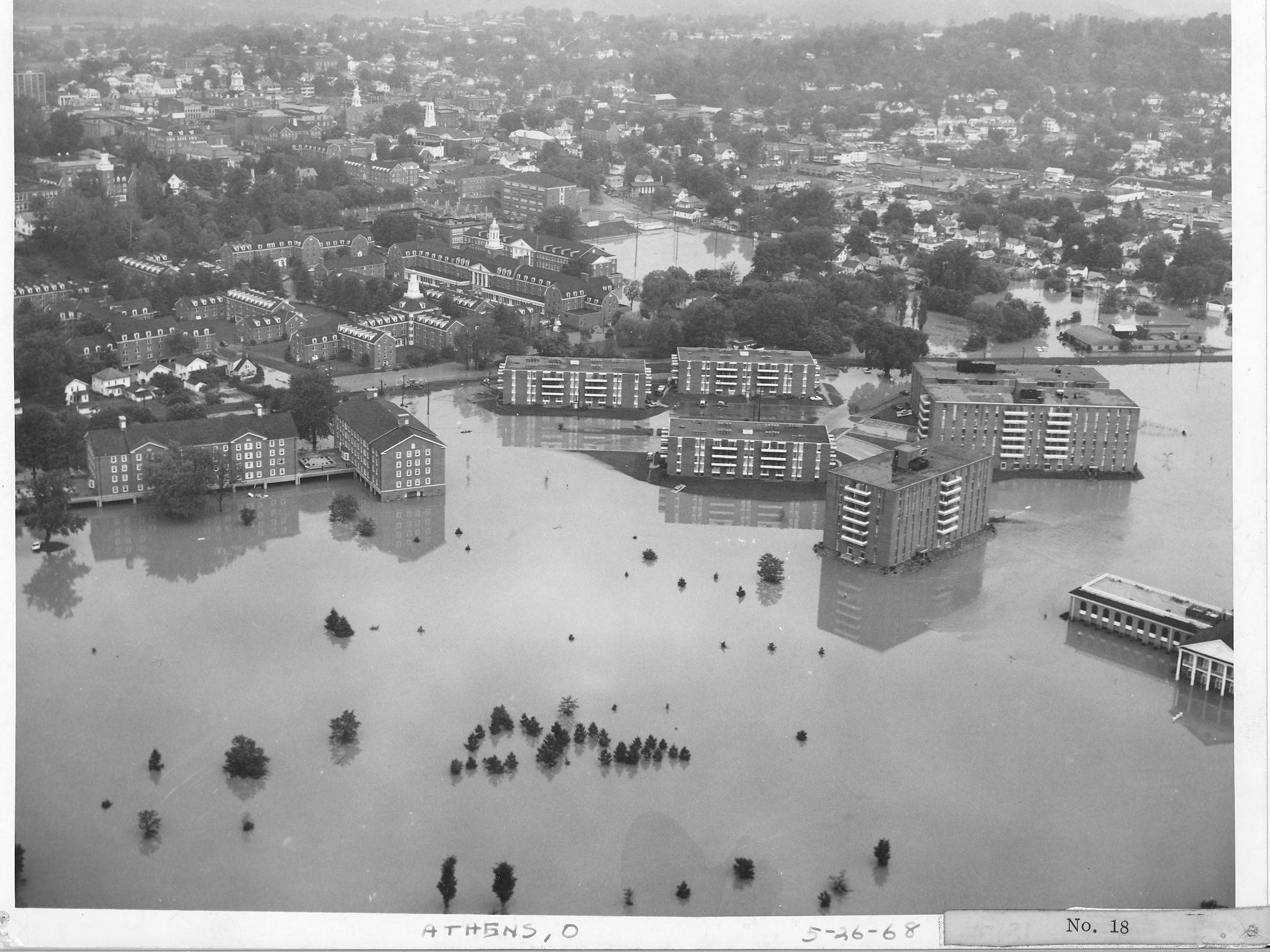
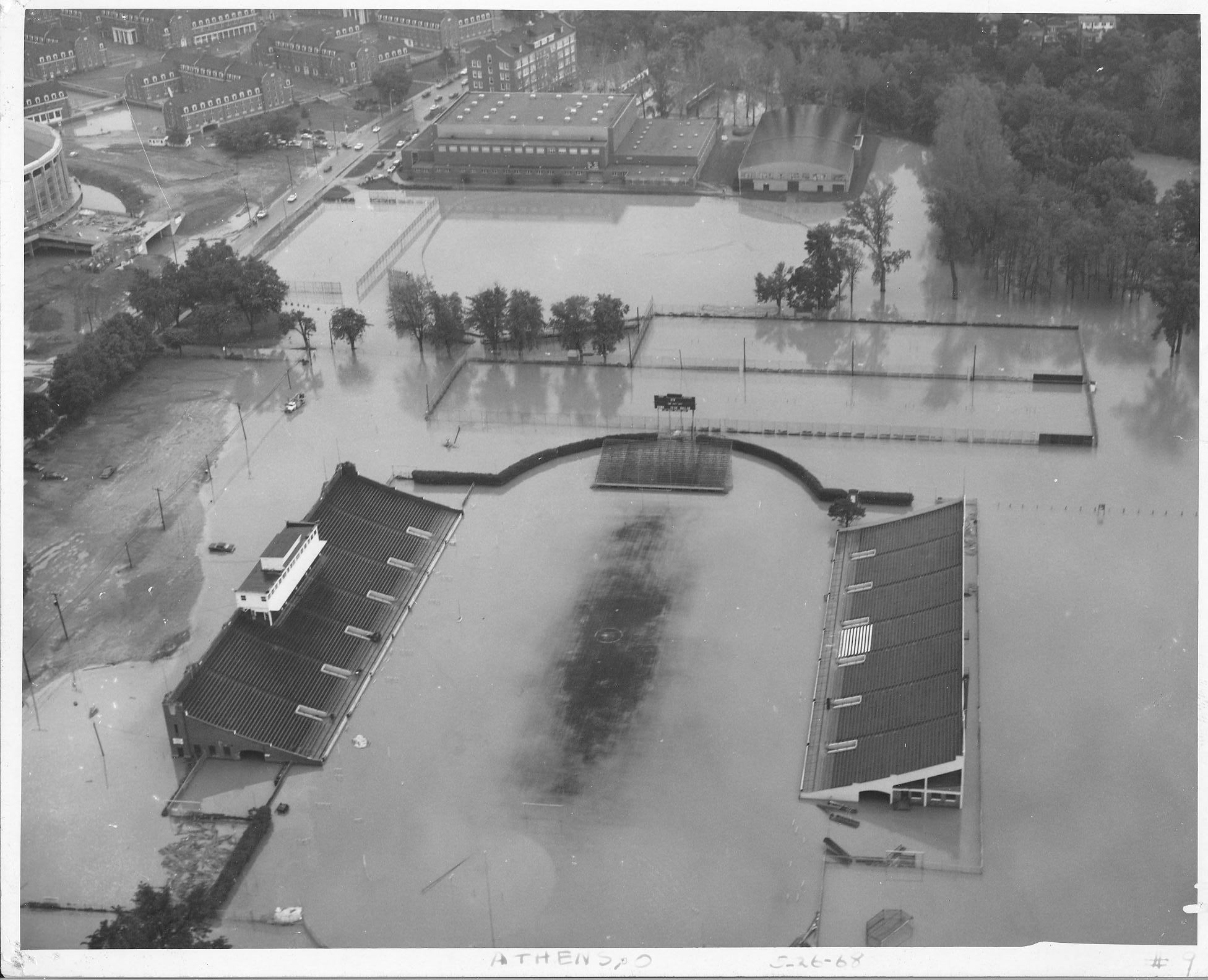
The highest flood recorded since the collection of stage data was initiated occurred May 25, 1968. This flood reached a crest of 24.65 feet, with a zero gauge elevation of 614.81 feet above mean sea level at river mile 31.62 in Athens. By comparison, this 1968 flood was 2.75 feet lower than the devastating flood of 1907. The Columbus Dispatch reported that the 1968 flood caused the deaths of three individuals in southern and southeastern Ohio and resulted in property damage estimated to be in the millions of dollars.

Moreover, the May 1968 flood wreaked havoc and set a new record for that period, cresting at 24.65 feet in Athens. This surpassed the previous significant flood crest of 24.20 feet, which occurred in March 1964. This string of flood events highlights the region’s vulnerability to severe flooding and the  impact such natural disasters can have on communities.

The greatest flood event with complete information occurred on March 14, 1907, when the river reached 27.4 feet, causing extensive damage in Athens and southeastern Ohio. According to the Athens Journal, seven people died during the flood and rescue attempts. Mr. Otto Barth, who drowned trying to rescue the John Dana family, was among them.

The flood uprooted about twenty houses, drowned many horses and cattle, and forced thousands to evacuate. Residents with rowboats rescued people, but some rescuers were among the seven who died. There were numerous arrests for looting in the following days.

Communication was severely disrupted as telegraph lines were down, isolating Athens from the outside world. The flooding also affected the railroad, waterworks, and electric plants, leaving the town without water and electricity.
Athens Local Protection Project (ALPP)

Channel Improvement

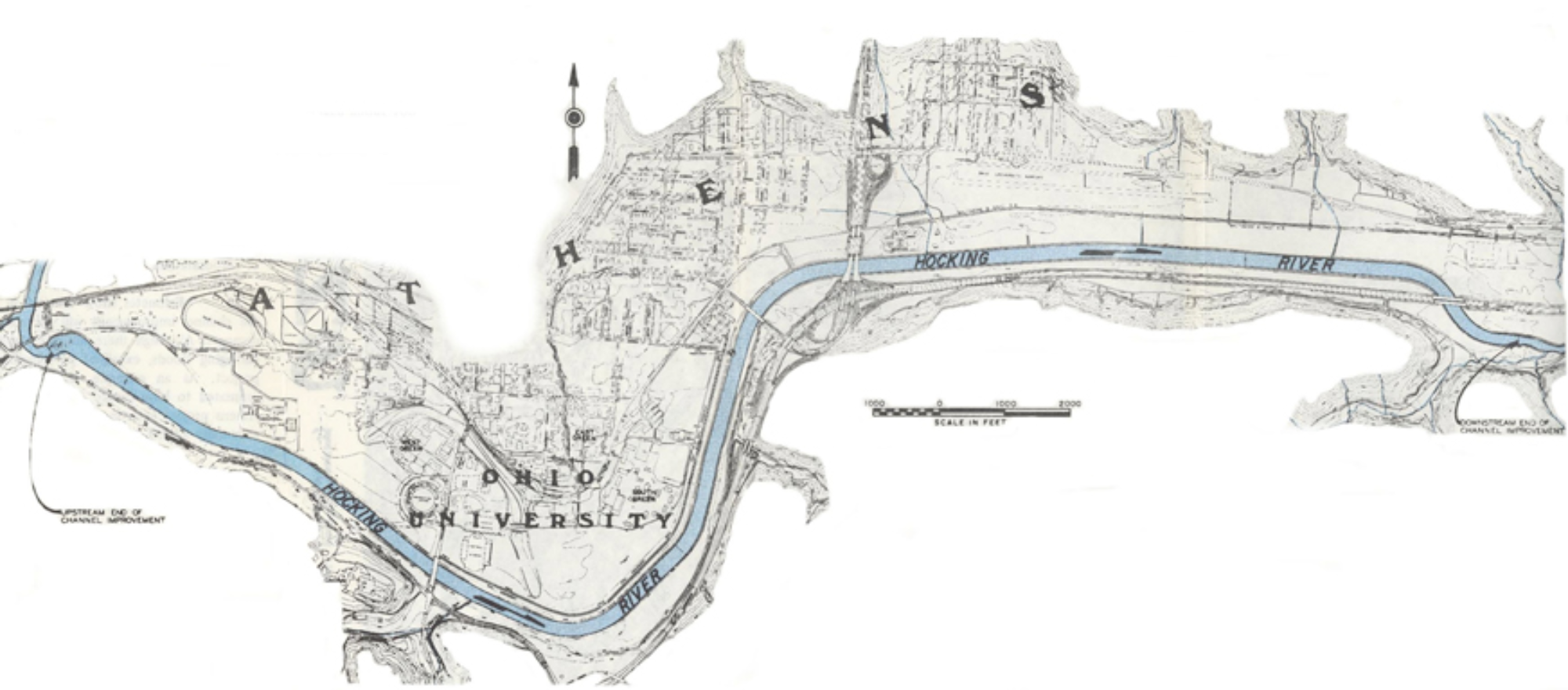
Prompted by substantial flood damages, the Athens Local Protection Project was authorized by the 1965 Flood Control Act, House Document No. 287, 89th Congress. The project, as shown on Figure 2, was constructed by the Huntington District, and was completed in 1971. The improvements consisted of realignment, straightening, and enlarging 26,000 feet of the channel to a bottom width of 215 feet. The project begins approximately 1000 feet downstream of the U.S. Route 50 bridge (current river mile 29.4) and extends upstream to the site of the White’s Mill Dam (current river mile 34.387). The improved channel shortened the river length through Athens by approximately 1,400 feet.

ALPP (Cont)

The material excavated from the new channel was utilized to fill abandoned portions of the original channel, to fill low areas adjacent to the new channel, and to construct a spoil bank between Richland Avenue (river mile 33.05) and Mill Street (river mile 31.61). This spoil bank is about 7,900 feet long with a top width of 100 feet and a top elevation varying from elevation 640.0 at Richland Avenue to elevation 638.5 at Mill Street. Although it was not designed as a levee, limited protection is provided to the area behind the embankment for floods of short duration. Spoil was also used to construct a second low bank that is approximately 400 feet in length along the left bank of the Hocking River between State Route 56 and the B & O Railroad at an elevation of 647.5. A large area north of State Route 56 is protected from short duration flooding by this spoil bank.

ALPP (Cont)

The flood of March 1964, the maximum recorded flood at Athens prior to the study for the GDM, dated March 1968, was selected as the design flood for the project. This flood had a peak discharge of 32,900 cfs at the former Mill Street gage. The design level of protection has been stated to be approximately 60 years. However, current hydrologic records indicate that a 40 to 50-year frequency is a more appropriate estimate.

Links for More Information

Explore detailed information about the Hocking River, including it’s history, key terms, and significant aspects of it’s ecosystem and management